Due to elevated fire danger, the City of Phoenix has implemented Stage 1 Fire Restrictions. All consumer fireworks are prohibited within one mile of mountain preserves, desert parks, regional parks, conservation areas, national forests, and wilderness areas.
Streets Maps
-
Capital Improvement Records and Maps
Review Phoenix's capital improvement records and maps for detailed insights into city infrastructure projects and developments.
-
Land Survey Elevation Marker
Discover Phoenix's land survey elevation markers for accurate mapping and GIS data. Access essential survey information for your projects.
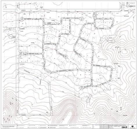
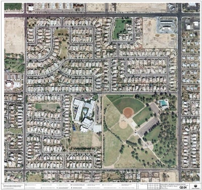
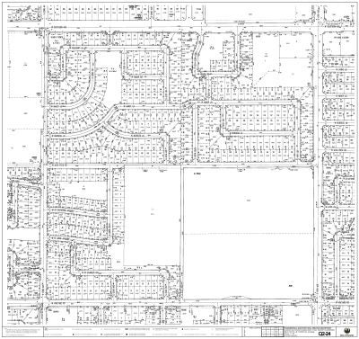
Types of Quarter Section (QS) Maps
There are 4 types distributed by Central Records:
- Aerial
- Right of Way (Landbase)
- Storm Drain
- Topographic (10' Contour)
You can easily identify which quarter section you are interested in by looking on the QS-Index map and using major cross roads to locate your site area.
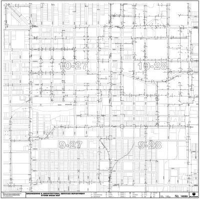
Customers who desire a STORM DRAIN MAP must meet the criteria set out in the STORMWATER DATA SECURITY policy and complete the following steps:
- Submit a Public Record Request through the City of Phoenix Communication's Office Web Site
- MUST be a partnering GOVERNMENT AGENCY or a UTILITY COMPANY (with a utility company ID badge – not a consultant working for the utility company)
- Be working on a CITY OF PHOENIX project OR preparing a Request for Proposal (RFP) – we need the PROJECT # AND THE CITY PROJECT MANAGERS NAME so we can verify the information before we provide the requested maps.
- Completing a commercial development. The cost for a COMMERCIAL customer for each GIS Quarter Section Storm Drain Map is $40.
No exceptions to policy requirements will be made. Similar to facility plans, Storm Drain Maps are protected under Ordinance G-4396.